The Dales Way - Day Five - Ribblehead to Sedbergh
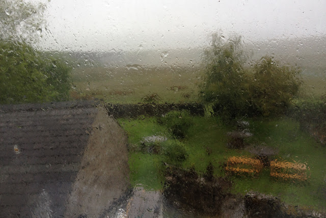
On the morning of our fifth day on the Dales Way I awoke with a sense of eager anticipation. I was about to tick an item off my very humble bucket list - to awake to a view of the rising sun illuminating the western slopes of Whernside. An uninterrupted view of wide open spaces, the Ribblehead viaduct and Yorkshire's highest peak. I leapt out of bed, threw back the curtains and blinked. I could barely see beyond the end of the pub's beer garden. Where was Whernside? Where was the viaduct? The wide open spaces? All had vanished beneath a thick blanket of saturated, dense cloud; our room window dappled with raindrops.
My disappointment lasted for all of a few seconds. We'd had a great time at the Station Inn - our room, the food, the staff - all had been lovely. A missing tick off my bucket list simply meant we'd have to stay here again one day. And that was certainly a prospect to savour.
Breakfast at the Station Inn was something of a hectic affair. Not only does the inn have several letting bedrooms but it also accommodates walkers and cyclists in an adjoining bunkhouse. And it seemed that everyone had turned up for breakfast at once. In the queue to use the toaster I recognised a lady walker from the George at Hubberholme and we chatted briefly about the prospect of a wet day's walking ahead. Like us, she and the rest of her party of four were heading for Sedbergh. Tom and I would have to get a head start again, I thought, as I returned to the table with a stack of toast.
The rain was still falling steadily as we checked out of the Station Inn. As we did so I bought a couple of pork pies and Mars Bars for our lunch, hoping we'd find some shelter along the way. The heavy rain clouds looked like they'd settled in for the day.
Suitably covered from head to toe in waterproofs, we set off to walk the mile and a half back along the Blea Moor road to pick up the Dales Way where we'd left it the night before. The rain was driving into our faces as we walked along the side of the road and, even though the traffic was light at this time of day, I was still grateful once we'd got off the road and joined the grassy track which headed over the hills in the direction of Dentdale. As we turned onto the Dales Way I looked back along the road and could make out four brightly coloured shapes heading in our direction. It was the party of four, each dressed in a different coloured waterproof jacket. They seemed to be gaining on us fast. Heads down into the wind, we picked up our pace and strode purposefully along the track.
The path began to climb steadily uphill, leading us almost into the clouds. Even though we were denied the stunning views my guidebook had promised for this section of the walk, it was still very beautiful, in a moody, atmospheric kind of way.

As usual, that morning before we set out I had studied my copy of the Dales Way guidebook, to familiarise myself with the day's route. And in doing so I'd been left with something of a dilemma. After crossing the edge of Blea Moor the main route of the Dales Way follows the road into Dentdale, passing under the Dent Head viaduct. However, the guidebook also suggests what is described as "a more adventurous walk", climbing uphill to cross Newby Head to follow the ancient Galloway Gate drove road, once used by Scottish cattle drovers. So far, it has to be said, most of the walk had been fairly low level, and I had missed the challenge of a higher route. But then the low clouds and driving rain made the prospect of a possibly sheltered route on lower ground seem more appealing. Glancing over my shoulder I could see the brightly clad party of four were gaining on us quickly as we turned onto a track which I believed would take us down to the road to Dent. As we began the descent I looked behind me again and for a moment it seemed as if the other walkers had vanished, until I spotted them walking straight ahead, past the point where we had turned. Had they gone the wrong way or had we? A quick glance at the GPS and I soon realised my error. We had turned off the path way too soon, there being at least another mile to go before we would reach the road. The cloud began to lift a little and the rain eased to a persistent drizzle as we returned to follow the correct path.

Before long we spotted the party of four ahead of us, the sound of their voices drifting towards us on the wind. They had stopped to check their map and I realised that we would soon catch them up again.
"I don't fancy this all the way to Sedbergh," I said to Tom.
"Neither do I," he replied. "Adventurous route then?"
"Definitely!"
And so it was, when we eventually reached the Dent road, the colourful foursome turned left and we turned right in the direction of the track up Newby Head. I have a feeling they must have thought we'd gone the wrong way again and, later that day when I saw them at our hotel, I was briefly tempted to go over and proudly announce "We opted for the adventurous route". I didn't, of course.
In spite of the rain and the weight of my backpack it felt good to be walking uphill as we followed the track which led us up the side of Wold Fell in the direction of Great Knoutberry Hill. For a while the cloud enveloped us and the entire world seemed wet and grey until, suddenly, the clouds began to lift and a tiny chink of sunlight broke through shedding a hazy light on the land below to the north. For a short time the rainfall subsided and I stopped in my tracks, listening to the silence, interrupted only by the call of a curlew. It was, quite simply, awesome and, even though I was drenched, in that moment there was nowhere else I would rather have been.

The "adventurous" alternative route continued from this point, skirting around the edge of Great Knoutberry before descending to Dent Station and rejoining the Dent road at Lea Yeat. We, however, turned to descend to the road via Arten Gill. There were two reasons I had decided to follow a shorter alternative to the "alternative". Firstly, I wanted to take a look at Artengill Viaduct which was built from a local stone known as "black marble". This is a limestone with a high carbon content which gives it a marble-like appearance, made popular by the Victorians for items such a fireplaces and architectural columns. And, secondly, descending via Arten Gill would lead us directly to a pub.
As we followed the rocky track down the gill it began to rain again and I realised that, for a short time at the top of the hill, we had almost been above the low cloud cover. Now, as the viaduct came into view, I was disappointed to have to stow my camera safely away inside my rucksack. The view was lovely but I just daren't risk it getting a soaking, and so I had to rely on Tom taking a quick snap on his iphone. I rather like the image he captured, in spite of it having been heavily manipulated. Even in a downpour it was a wildly beautiful place.

As we passed under the viaduct's majestic arches the clouds began to drift apart and the rain eased a little, enabling me to retrieve my camera and take my own shot of this magnificent example of Victorian industrial architecture.

We rejoined the Dent road just beyond the viaduct and a short distance along the road brought us to the welcoming sight of The Sportsman Inn. In spite of being completely covered in waterproofs the rain had still found its way inside my jacket and my base layer felt very cold and soggy. The pub wasn't serving food that day so, after visiting the toilets to change out of our wet clothes, we bought a bag of crisps each and ensconced ourselves on a corner settle, out of sight of the bar, where we ate the crisps along with the pork pies I had bought from the Station Inn that morning. As we sat in the warmth and comfort of the inn the rain stopped completely and the sky began to brighten. Fortified for the rest of the journey by a couple of pints of beer, we were soon keen to be on our way again.

Now we were following another river, the Dee, which runs through Dentdale, sometimes disappearing beneath its limestone bed to flow through a system of underground caverns.

We continued to follow the road to Lea Yeat, a bridge marking the spot where we would have rejoined the road, had we chosen to follow the entirety of the alternative route.

After Lea Yeat the Dales Way left the road for a while, following a riverside path alongside the edge of a campsite at Cow Dub. I recognised this place from a previous visit. Whilst camping here, several years ago, I had an accident I will never forget. It was a very hot day and the exertion of pitching our tent had left us very hot and thirsty. Tom climbed down the bank to the river to splash some of the cold, clear water onto his face, calling out for me to join him. Foolishly I leapt down the bank and directly onto the rocks. I was wearing sunglasses which meant that I failed to notice how slick and slippery those rocks were and, before I knew anything about it, I had fallen backwards with some force, slamming the back of my head hard onto a slab of limestone. I lost consciousness for a while and came round to see what looked like a television screen of white, fuzzy interference. Tom's "first aid" consisted of applying a piece of tissue paper to a cut on my elbow before marching me the mile and a half along the road to the Sportsman Inn (which had been closed!) and back again. At the time I thought it was a bit harsh, but bizarrely it seems to have been exactly the right thing to do and I suffered nothing more than a concussion and a painful bruise to the back of my head. I have never forgotten those particular rocks. Which is why I paused to take a photo as we passed them by.

Beyond the campsite we rejoined the road again, passing a farm with a wonderful collection of vintage cars and tractors, in various states of preservation. I was especially delighted to see a charming little black car, which I believe was an Austin Seven. I could just imagine taking it for a spin along the picturesque road winding its way through Dentdale, with an old-fashioned picnic basket, thermos flask and tartan rug in the boot.

We left the road shortly after the farm at Cow Dub and ascended a little way up the side of the valley. The afternoon was brightening all the while and we were happy to be able to remove our waterproof outer layer. The landscape looked green and lush, having recently been washed by the morning's rainfall.

As we turned to follow a farm track to rejoin the road, we passed a wire fence which someone had decorated with dead moles. To our modern sensibilities this could be seen as barbaric, but this ancient custom has its practical side. A farmer whose land has been plagued by these little earth-moving rodents employs a mole catcher, paying an agreed amount per mole, and the stringing of their corpses on a fence is the best way to prove how many have been caught. Country ways! (A pound a mole? That'll be £17 then please!)

We followed the road for a couple of miles or so before leaving it again to cross over the River Dee by a wooden footbridge onto which was affixed a plaque reading "This bridge was erected by No 140 Airmen Aircrew Initial Training Course from RAF Finningley on 27-28 June 1987". Quite what building a bridge at this particular place had to do with aircrew training escaped me, but it was nevertheless a pleasant little bridge in a very pretty, leafy spot.

On the other side of the bridge we continued to follow the course of the Dee, passing through meadows lush with grass and buttercups. I breathed deeply as I walked, savouring the sweet air and the scent of freshly washed grass.

Looking back in the direction of Arten Gill and Great Knoutberry Hill beyond, the clouds were still shrouding the high ground. It looked as though it was still very wet up there, but down here, in the valley bottom, there were signs that the sun may soon break through the clouds.

Sure enough, a short while later, the sun did put in a brief appearance and in the distance I caught my first glimpse of the village of Dent and an area of geological significance beyond, known as the Dent Fault .

The day was passing quickly and we reached Dent a little after 4 p.m. with just over five miles remaining to our evening destination of Sedbergh. The Dales Way actually bypasses Dent, although a visit to the village centre only entails a very short detour. Even so, after a short rest break by a bridge, we decided to press on, following the River Dee to the north of the village.

Unlike the River Wharfe, which dwindled in size as we followed its course, the River Dee became wider after we had passed Dent, as it meanders its way to the point where it flows into the River Rawthey close to Sedbergh.

Suddenly I realised that we were now no longer in Yorkshire. At some point during the day we had arrived in Cumbria! And, as we drew ever nearer to Sedbergh, the hills did begin to look decidedly Cumbrian in character. As much as I liked Dentdale, I felt uplifted to recognise this change in the landscape. To me, this was the most beautiful scenery I had seen all day.

At Brackensgill the Dales Way turned away from the River Dee and climbed the side of a hill. At the top we entered a small woodland area following a track through the trees.

The track emerged from the woods to follow a path between drystone walls. At this point we worked out that we had walked around 17 miles and I had begun to feel tired. The change in the landscape, however, signalled the end of the day's walk was drawing near and, as we walked towards the crest of a hill between the walls, I knew that we would soon have our destination in sight.

Sure enough, as we turned a corner on the brow of the hill, we were rewarded with a view of Sedbergh, nestling at the foot of the Howgill Fells. And what a welcome sight it was! I'm very fond of Sedbergh and the Howgills at the best of times, but never more so than I was in this moment. Down there was a comfy place to sit, a refreshing shower, a cool glass of beer and a hot meal. A delightful prospect at the end of this, our longest day's walk.

As we made our way through the streets of Sedbergh in the direction of our base for the night at the Dalesman Country Inn, my attention was drawn to a charming stone cottage with a delightful, vibrant garden. It was a wonderfully cheerful sight on a day which had been rather drained of colour and, quite literally, it brightened my day. This, unfortunately, is more than could be said for our room at the Dalesman which was rather drab with its grey painted walls and lack of windows. Thankfully the excellent food and beer on offer, combined with the friendly staff, made up for this cheerlessness and after dinner we were sufficiently revived to take a short walk around the delightful little streets of Sedbergh before returning to our grey, windowless room.

It had been rather a long, tiring day but nonetheless enjoyable. The following day was to entail a walk of around 16 miles through a landscape which was completely unfamiliar to me. And, if the forecast was to be relied upon, we would be enjoying a day of much kinder weather.
Total distance walked: 18.49 miles
Total walking time: 8 hours 47 minutes (including lunch break)
Next time...The penultimate day of our Dales Way journey takes us through the Lune Valley, crossing the M6 motorway and the West Coast Mainline before arriving in Burneside near Kendal.
My disappointment lasted for all of a few seconds. We'd had a great time at the Station Inn - our room, the food, the staff - all had been lovely. A missing tick off my bucket list simply meant we'd have to stay here again one day. And that was certainly a prospect to savour.

View? What view?
Breakfast at the Station Inn was something of a hectic affair. Not only does the inn have several letting bedrooms but it also accommodates walkers and cyclists in an adjoining bunkhouse. And it seemed that everyone had turned up for breakfast at once. In the queue to use the toaster I recognised a lady walker from the George at Hubberholme and we chatted briefly about the prospect of a wet day's walking ahead. Like us, she and the rest of her party of four were heading for Sedbergh. Tom and I would have to get a head start again, I thought, as I returned to the table with a stack of toast.
The rain was still falling steadily as we checked out of the Station Inn. As we did so I bought a couple of pork pies and Mars Bars for our lunch, hoping we'd find some shelter along the way. The heavy rain clouds looked like they'd settled in for the day.
Suitably covered from head to toe in waterproofs, we set off to walk the mile and a half back along the Blea Moor road to pick up the Dales Way where we'd left it the night before. The rain was driving into our faces as we walked along the side of the road and, even though the traffic was light at this time of day, I was still grateful once we'd got off the road and joined the grassy track which headed over the hills in the direction of Dentdale. As we turned onto the Dales Way I looked back along the road and could make out four brightly coloured shapes heading in our direction. It was the party of four, each dressed in a different coloured waterproof jacket. They seemed to be gaining on us fast. Heads down into the wind, we picked up our pace and strode purposefully along the track.
The path began to climb steadily uphill, leading us almost into the clouds. Even though we were denied the stunning views my guidebook had promised for this section of the walk, it was still very beautiful, in a moody, atmospheric kind of way.

Into the clouds
As usual, that morning before we set out I had studied my copy of the Dales Way guidebook, to familiarise myself with the day's route. And in doing so I'd been left with something of a dilemma. After crossing the edge of Blea Moor the main route of the Dales Way follows the road into Dentdale, passing under the Dent Head viaduct. However, the guidebook also suggests what is described as "a more adventurous walk", climbing uphill to cross Newby Head to follow the ancient Galloway Gate drove road, once used by Scottish cattle drovers. So far, it has to be said, most of the walk had been fairly low level, and I had missed the challenge of a higher route. But then the low clouds and driving rain made the prospect of a possibly sheltered route on lower ground seem more appealing. Glancing over my shoulder I could see the brightly clad party of four were gaining on us quickly as we turned onto a track which I believed would take us down to the road to Dent. As we began the descent I looked behind me again and for a moment it seemed as if the other walkers had vanished, until I spotted them walking straight ahead, past the point where we had turned. Had they gone the wrong way or had we? A quick glance at the GPS and I soon realised my error. We had turned off the path way too soon, there being at least another mile to go before we would reach the road. The cloud began to lift a little and the rain eased to a persistent drizzle as we returned to follow the correct path.

Back on track
Before long we spotted the party of four ahead of us, the sound of their voices drifting towards us on the wind. They had stopped to check their map and I realised that we would soon catch them up again.
"I don't fancy this all the way to Sedbergh," I said to Tom.
"Neither do I," he replied. "Adventurous route then?"
"Definitely!"
And so it was, when we eventually reached the Dent road, the colourful foursome turned left and we turned right in the direction of the track up Newby Head. I have a feeling they must have thought we'd gone the wrong way again and, later that day when I saw them at our hotel, I was briefly tempted to go over and proudly announce "We opted for the adventurous route". I didn't, of course.
In spite of the rain and the weight of my backpack it felt good to be walking uphill as we followed the track which led us up the side of Wold Fell in the direction of Great Knoutberry Hill. For a while the cloud enveloped us and the entire world seemed wet and grey until, suddenly, the clouds began to lift and a tiny chink of sunlight broke through shedding a hazy light on the land below to the north. For a short time the rainfall subsided and I stopped in my tracks, listening to the silence, interrupted only by the call of a curlew. It was, quite simply, awesome and, even though I was drenched, in that moment there was nowhere else I would rather have been.

Above the clouds
The "adventurous" alternative route continued from this point, skirting around the edge of Great Knoutberry before descending to Dent Station and rejoining the Dent road at Lea Yeat. We, however, turned to descend to the road via Arten Gill. There were two reasons I had decided to follow a shorter alternative to the "alternative". Firstly, I wanted to take a look at Artengill Viaduct which was built from a local stone known as "black marble". This is a limestone with a high carbon content which gives it a marble-like appearance, made popular by the Victorians for items such a fireplaces and architectural columns. And, secondly, descending via Arten Gill would lead us directly to a pub.
As we followed the rocky track down the gill it began to rain again and I realised that, for a short time at the top of the hill, we had almost been above the low cloud cover. Now, as the viaduct came into view, I was disappointed to have to stow my camera safely away inside my rucksack. The view was lovely but I just daren't risk it getting a soaking, and so I had to rely on Tom taking a quick snap on his iphone. I rather like the image he captured, in spite of it having been heavily manipulated. Even in a downpour it was a wildly beautiful place.

Arten Gill
As we passed under the viaduct's majestic arches the clouds began to drift apart and the rain eased a little, enabling me to retrieve my camera and take my own shot of this magnificent example of Victorian industrial architecture.

Artengill Viaduct
We rejoined the Dent road just beyond the viaduct and a short distance along the road brought us to the welcoming sight of The Sportsman Inn. In spite of being completely covered in waterproofs the rain had still found its way inside my jacket and my base layer felt very cold and soggy. The pub wasn't serving food that day so, after visiting the toilets to change out of our wet clothes, we bought a bag of crisps each and ensconced ourselves on a corner settle, out of sight of the bar, where we ate the crisps along with the pork pies I had bought from the Station Inn that morning. As we sat in the warmth and comfort of the inn the rain stopped completely and the sky began to brighten. Fortified for the rest of the journey by a couple of pints of beer, we were soon keen to be on our way again.

The Sportsman Inn
Now we were following another river, the Dee, which runs through Dentdale, sometimes disappearing beneath its limestone bed to flow through a system of underground caverns.

The River Dee
We continued to follow the road to Lea Yeat, a bridge marking the spot where we would have rejoined the road, had we chosen to follow the entirety of the alternative route.

Lea Yeat
After Lea Yeat the Dales Way left the road for a while, following a riverside path alongside the edge of a campsite at Cow Dub. I recognised this place from a previous visit. Whilst camping here, several years ago, I had an accident I will never forget. It was a very hot day and the exertion of pitching our tent had left us very hot and thirsty. Tom climbed down the bank to the river to splash some of the cold, clear water onto his face, calling out for me to join him. Foolishly I leapt down the bank and directly onto the rocks. I was wearing sunglasses which meant that I failed to notice how slick and slippery those rocks were and, before I knew anything about it, I had fallen backwards with some force, slamming the back of my head hard onto a slab of limestone. I lost consciousness for a while and came round to see what looked like a television screen of white, fuzzy interference. Tom's "first aid" consisted of applying a piece of tissue paper to a cut on my elbow before marching me the mile and a half along the road to the Sportsman Inn (which had been closed!) and back again. At the time I thought it was a bit harsh, but bizarrely it seems to have been exactly the right thing to do and I suffered nothing more than a concussion and a painful bruise to the back of my head. I have never forgotten those particular rocks. Which is why I paused to take a photo as we passed them by.

I remember this place....surprisingly!
Beyond the campsite we rejoined the road again, passing a farm with a wonderful collection of vintage cars and tractors, in various states of preservation. I was especially delighted to see a charming little black car, which I believe was an Austin Seven. I could just imagine taking it for a spin along the picturesque road winding its way through Dentdale, with an old-fashioned picnic basket, thermos flask and tartan rug in the boot.

Charming little motor car
We left the road shortly after the farm at Cow Dub and ascended a little way up the side of the valley. The afternoon was brightening all the while and we were happy to be able to remove our waterproof outer layer. The landscape looked green and lush, having recently been washed by the morning's rainfall.

Beautiful Dentdale
As we turned to follow a farm track to rejoin the road, we passed a wire fence which someone had decorated with dead moles. To our modern sensibilities this could be seen as barbaric, but this ancient custom has its practical side. A farmer whose land has been plagued by these little earth-moving rodents employs a mole catcher, paying an agreed amount per mole, and the stringing of their corpses on a fence is the best way to prove how many have been caught. Country ways! (A pound a mole? That'll be £17 then please!)

Country ways
We followed the road for a couple of miles or so before leaving it again to cross over the River Dee by a wooden footbridge onto which was affixed a plaque reading "This bridge was erected by No 140 Airmen Aircrew Initial Training Course from RAF Finningley on 27-28 June 1987". Quite what building a bridge at this particular place had to do with aircrew training escaped me, but it was nevertheless a pleasant little bridge in a very pretty, leafy spot.

A bridge built by airmen
On the other side of the bridge we continued to follow the course of the Dee, passing through meadows lush with grass and buttercups. I breathed deeply as I walked, savouring the sweet air and the scent of freshly washed grass.

Lush meadows
Looking back in the direction of Arten Gill and Great Knoutberry Hill beyond, the clouds were still shrouding the high ground. It looked as though it was still very wet up there, but down here, in the valley bottom, there were signs that the sun may soon break through the clouds.

Looking back
Sure enough, a short while later, the sun did put in a brief appearance and in the distance I caught my first glimpse of the village of Dent and an area of geological significance beyond, known as the Dent Fault .

Distant Dent
The day was passing quickly and we reached Dent a little after 4 p.m. with just over five miles remaining to our evening destination of Sedbergh. The Dales Way actually bypasses Dent, although a visit to the village centre only entails a very short detour. Even so, after a short rest break by a bridge, we decided to press on, following the River Dee to the north of the village.

Dent
Unlike the River Wharfe, which dwindled in size as we followed its course, the River Dee became wider after we had passed Dent, as it meanders its way to the point where it flows into the River Rawthey close to Sedbergh.

The River Dee widens
Suddenly I realised that we were now no longer in Yorkshire. At some point during the day we had arrived in Cumbria! And, as we drew ever nearer to Sedbergh, the hills did begin to look decidedly Cumbrian in character. As much as I liked Dentdale, I felt uplifted to recognise this change in the landscape. To me, this was the most beautiful scenery I had seen all day.

Middleton Fell...in Cumbria!
At Brackensgill the Dales Way turned away from the River Dee and climbed the side of a hill. At the top we entered a small woodland area following a track through the trees.

Entering woodland
The track emerged from the woods to follow a path between drystone walls. At this point we worked out that we had walked around 17 miles and I had begun to feel tired. The change in the landscape, however, signalled the end of the day's walk was drawing near and, as we walked towards the crest of a hill between the walls, I knew that we would soon have our destination in sight.

Over the hill and round the corner
Sure enough, as we turned a corner on the brow of the hill, we were rewarded with a view of Sedbergh, nestling at the foot of the Howgill Fells. And what a welcome sight it was! I'm very fond of Sedbergh and the Howgills at the best of times, but never more so than I was in this moment. Down there was a comfy place to sit, a refreshing shower, a cool glass of beer and a hot meal. A delightful prospect at the end of this, our longest day's walk.

Sedbergh and the Howgill Fells
As we made our way through the streets of Sedbergh in the direction of our base for the night at the Dalesman Country Inn, my attention was drawn to a charming stone cottage with a delightful, vibrant garden. It was a wonderfully cheerful sight on a day which had been rather drained of colour and, quite literally, it brightened my day. This, unfortunately, is more than could be said for our room at the Dalesman which was rather drab with its grey painted walls and lack of windows. Thankfully the excellent food and beer on offer, combined with the friendly staff, made up for this cheerlessness and after dinner we were sufficiently revived to take a short walk around the delightful little streets of Sedbergh before returning to our grey, windowless room.

A splash of colour on a grey day
It had been rather a long, tiring day but nonetheless enjoyable. The following day was to entail a walk of around 16 miles through a landscape which was completely unfamiliar to me. And, if the forecast was to be relied upon, we would be enjoying a day of much kinder weather.
Total distance walked: 18.49 miles
Total walking time: 8 hours 47 minutes (including lunch break)
Next time...The penultimate day of our Dales Way journey takes us through the Lune Valley, crossing the M6 motorway and the West Coast Mainline before arriving in Burneside near Kendal.


Comments
Post a Comment