Cleveland Way: Day 1 - Helmsley to Kilburn

2016 was a bad year for celebrity deaths. David Bowie, Alan Rickman, Prince, George Michael, Victoria Wood to name just a few. 46 in all. The most famous person to leave my life in May 2016 was my mother. From diagnosis to death was just a short three weeks, rocking my world almost as abruptly as the sudden death of my father, 16 years earlier, aged just 65. If ever I needed to take a long walk, the summer of 2016 was the right time. Essentially orphaned, and having just been promoted to a full-time management role, the longer the walk the better. At 109 miles (175 km) the Cleveland Way fitted the bill nicely.
Getting to Helmsley by public transport involves a bus ride for the final part of the journey, whichever direction you’re coming from. We caught a train to Scarborough, followed by a two and a half hour bus ride to Helmsley. The bus seemed to stop off at every small village along the way, but this actually turned out to make for a pleasant journey as we visited, among others, the previously bypassed likes of Hutton Buscel, Wrelton and Beadlam. It also allowed for a comfort break in the market town of Pickering which was most welcome.

Awaiting breakfast at the Royal Oak, Helmsley
Judging by the sky, the rain appeared to be set in for the day ahead and so after we’d checked out of the Royal Oak we kitted ourselves out in full waterproofs in preparation for splashing our way to the starting point, which can be found by the side of a large car park, just off the High Street. Before we left the main market square though we called in at the excellent Hunter’s Delicatessen to stock up on some of their delicious sandwiches, savoury rolls and flapjack. Quite where we were going to find a picnic spot on such a gloomy day, I had no idea, but I was determined that find one we would.

Waterproofs on and ready for the off
A fieldside path climbed gently away from Helmsley before turning into Blackdale Howl Wood where a series of steep steps awaited us. After such a hearty breakfast this was something of a trial and already I was beginning to feel the full weight of my rucksack. Between us we were carrying everything we needed (or so I thought) for ten full days of walking. Having a pair of walking poles certainly helps, I find, and my rucksack was evenly distributed and well adjusted. Even so, all those steps made for something of a challenging start.

A bit of a tough start
Finally the ascent eased, unlike the rain which continued unabated. Heads down we trudged purposefully along, passing by the site of the deserted medieval village of Griff. I looked around me but it was impossible to make out any of the remains of the village through the murky haze. Already I was becoming used to the weight of my rucksack as I breathed in deeply, absorbing the heady scent of wet grass and cow parsley. And already my mind was beginning to still, as if the rain was washing away all thoughts of the inevitable and unenviable task of a post-bereavement house clearance at the same time as dealing with the learning curve of an expanded job description. All thoughts dripped steadily away with the raindrops as I simply put one foot in front of the other, focused on my breathing and felt sublimely content to be exactly where I was in this very moment. Even the nagging thought of where we would possibly be able to stop to sit down and eat our lunch was swiftly brushed aside. There is no finer therapy for life’s inevitable trials and traumas, I have found, than being surrounded by nature.
A steady tramp through dripping woodland brought us to the side of what looked life a cliff face but was actually once a quarry. This is Griff Bank Quarry and it is believed that some of the stone used in the building of nearby Rievaulx Abbey was extracted from this site.

Griff Bank Quarry
According to English Heritage, the sandstone used in the construction of Rievaulx was sourced from several quarries within a 10 mile radius of the abbey, although the finer, more ornamental stone was imported from further afield.
If it had been a brighter day, and if more time had been at our disposal, we may have made the short excursion off the trail to visit Rievaulx Abbey, which came into view as we emerged onto a road a short distance from the quarry. We’ve visited several times before, however, and today just wasn’t the right kind of day to do justice to this magnificent historical site. Founded in 1132, Rievaulx was the first Cistercian order in the north of England and quickly became one of the wealthiest and most spiritually renowned abbeys in England. Like all monastic orders of its time, it fell victim to dissolution under the reign of Henry VIII. I snapped a quick, dull picture across the sodden foreground fields and we continued on our way.

Rievaulx Abbey
The road crossed the River Rye at Rievaulx Bridge, a triple-arched 18th century bridge where Turner had stood in 1826 to paint his picture of Rievaulx Abbey, now displayed in York Art Gallery. Trying to reproduce the scene painted by Turner is impossible today, due to the number of trees along the riverbank, obscuring the view of the abbey. Even so, it’s clear that, as with many such masterpieces, a certain amount of artistic licence had been used, as shown below. Either that or those hills have eroded considerably in the past 100 years.

Rievaulx Abbey 1826, JMW Turner
From Rievaulx Bridge we followed the road for half a mile before turning onto a track which led into Nettle Dale. Although the rain had eased a little, large raindrops dripped off the trees which lined our route through this lush, green dale. The track passed by a series of spring-fed ponds, believed to have been created by the monks from Rievaulx Abbey in the 12th century, and onto which raindrops and a light breeze now cast a rippling pattern.

Nettle Dale pond
Across the pond we could see a small shed or boathouse. I was by now looking forward to finding somewhere to sit down and enjoy my packed lunch. Would the shed be locked, I wondered? This certainly seemed like an idyllic spot to enjoy a picnic in the rain, provided a certain amount of shelter could be found. Deciding that this might be classed as trespass, we continued along the track until it turned to cross a series of stepping stones and a footbridge which led us into Flassen Dale. And here the most incredible sight met my eyes.
I could not believe our luck for there, just a couple of hundred yards or so along the dale, was the most perfectly placed, beautifully constructed wooden picnic shelter. It was so unexpected, so ideally situated, so, well, perfect, that I decided I must have performed some unconscious kind of magical manifestation. But what on earth was it doing here? In the middle of nowhere?
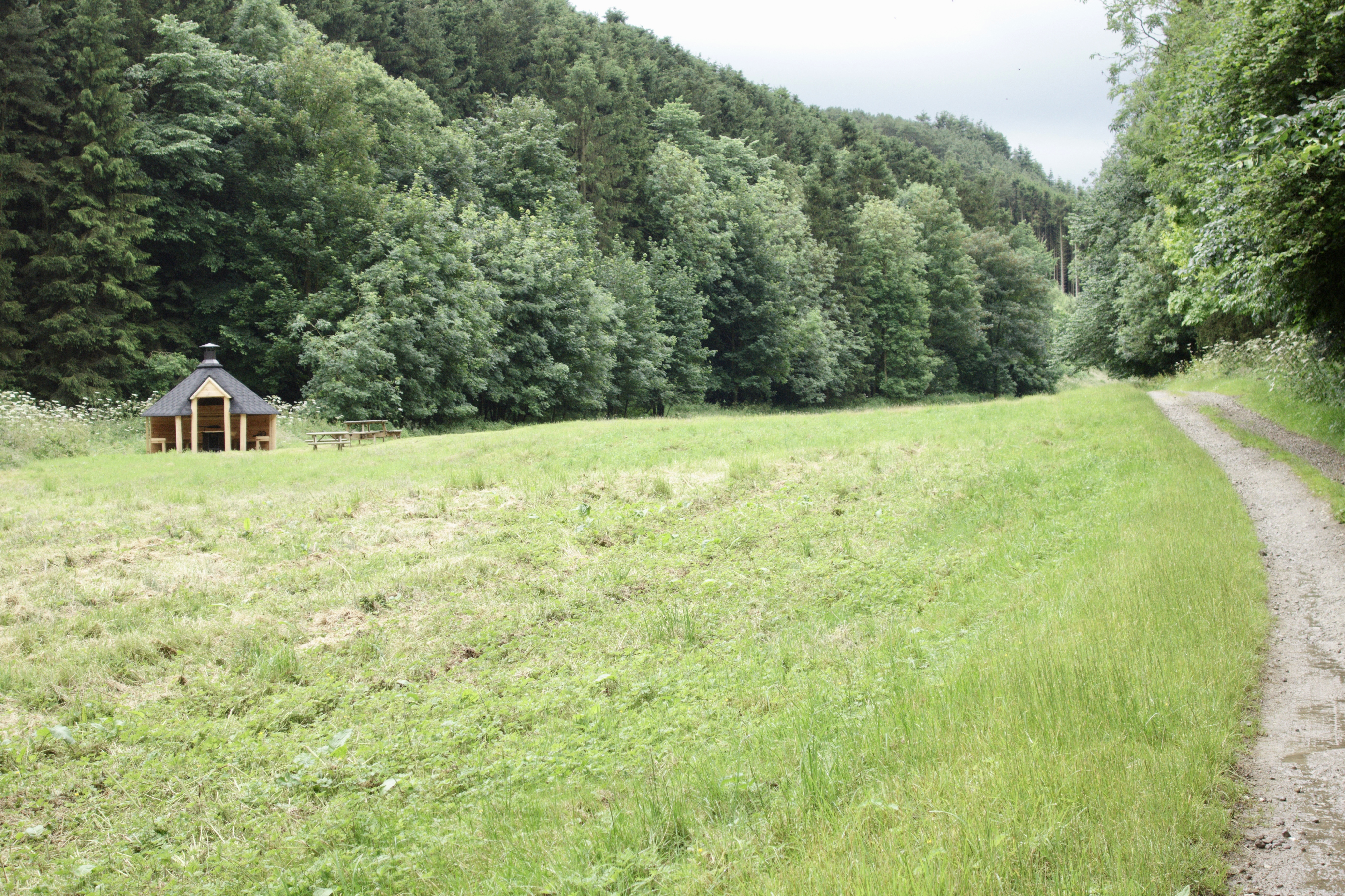
Magically manifested shelter
Apart from the track, there were no other signs of occupation in this peaceful little valley. No houses, no other picnic tables, nothing to suggest what this lovely little structure was doing right here. My best guess was that it might have been built as a place for shooting parties to gather for refreshments. It might, of course, just as easily have been provided for public use by the National Park authority, but whatever its purpose, it was certainly a welcome sight.
There was no one else around. In fact, apart from a post van crossing the bridge at Rievaulx, we hadn’t seen another person since we’d left Helmsley. There were no “private”, “keep out” signs or anything of that nature. The little structure was enticingly positioned just yards away from the public right of way. We didn’t need to think twice and in no time at all we’d settled ourselves under the welcome shelter of its beautifully made roof.

Perfect place for a picnic
There were picnic tables on the outside and a bench ran along the inside, surrounding a central fire pit. As the rain continued to beat down we were able to remove our waterproofs and give them a shake before sitting back in comfort to enjoy our feast. Our walking pace, it seemed, had matched the persistence of the rain and we were well ahead of our schedule for the day. And so it was that we spent over an hour inside the shelter, lighting a fire within the fire pit to burn our litter. It was so peaceful with the gentle crackling of the fire, the thrumming of rain on the roof and the sound of wood pigeons purring contentedly in the surrounding trees. I could happily have spent a lot longer here, but eventually the time came to douse the fire and continue on our way.

Handy litter disposal
The Cleveland Way turned off the track through Flassen Dale shortly after the picnic shelter and climbed steeply up through a patch of woodland to emerge into open farmland. Finally, the clouds began to break and the rain began to ease. The view was expansive in all directions, back towards Helmsley and the Howardian Hills and over to the North York Moors in the north and the air was sweet with the wonderful scent of rain-soaked grass. It stopped raining for a short time and then, as we descended and passed through the village of Cold Kirby, a sudden, sharp downpour heralded the end of the rain, as if the clouds were giving a final flourish to their day’s work.
Above Cold Kirby
After the solitude of the past few hours, the mounting drone of traffic noise confirmed our approach to the busy A170, the traffic slowing as it neared the start of the steep descent of Sutton Bank. This 1 in 4 gradient hill is notorious for blockages caused by over-ambitious lorry ascents and those towing caravans are required to take an alternative route to avoid its hairpin bends and gear-grinding inclines. A gap in the traffic allowed us to make a quick dash across the road and continue along a heather-lined path through a small plantation, the thrum of the road noise fading with every step.
At this point my attention was drawn to a visible bank and ditch which runs along the side of the path and which I noted was marked on the Ordnance Survey map as “Casten Dike”. This stretch of ditch and bank is part of the wider Cleave Dyke system of linear earthworks that run parallel with and close to the western scarp of the Hambleton Hills. Archaeological investigations have shown that this earthworks boundary system was constructed in the Late Bronze Age (circa 1000 BC) to augment natural land divisions created by streams and hills. Today this section of ditch and bank is a Scheduled Ancient Monument, hence its italicised notation on the OS map.

Casten Dike
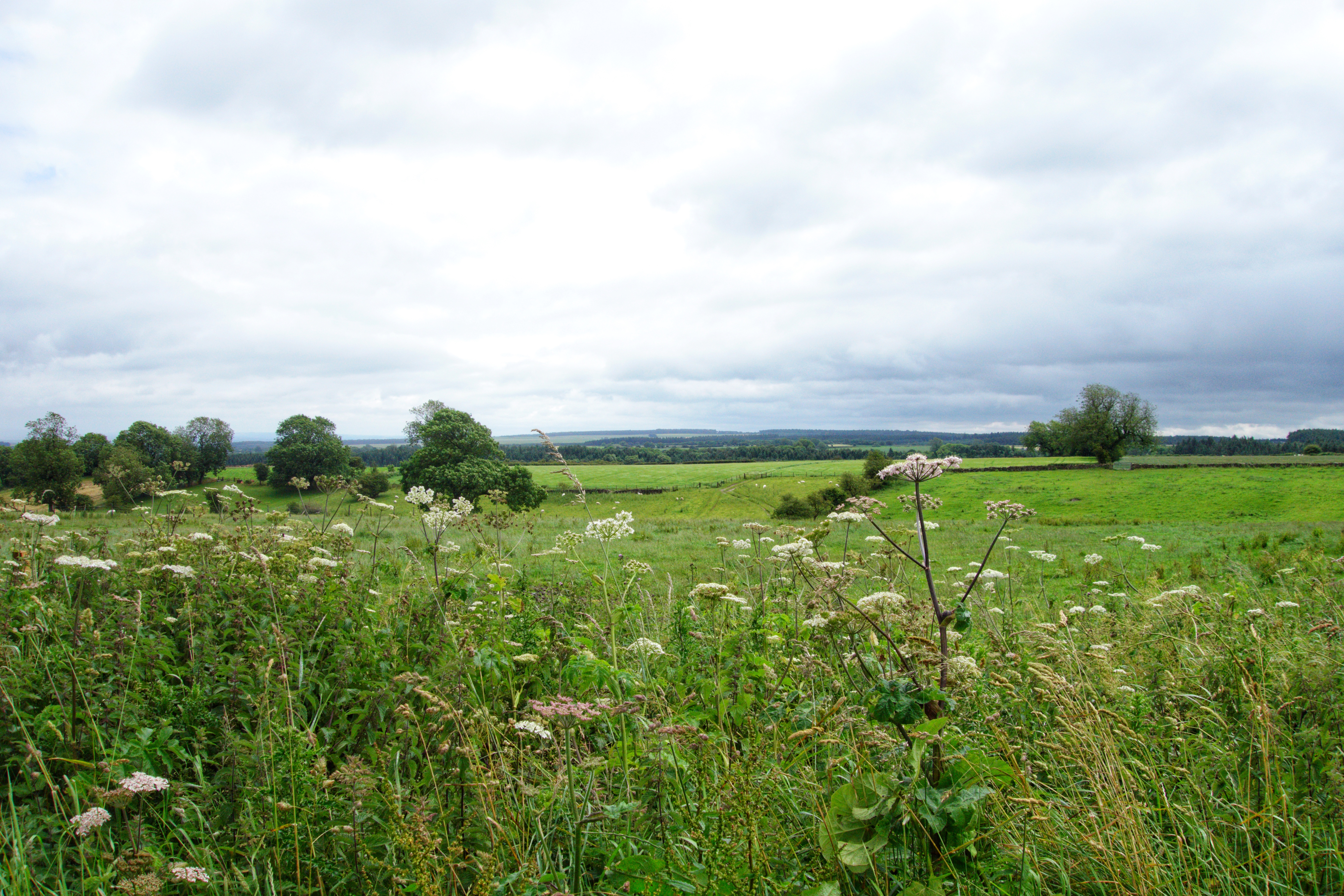
The path by Casten Dike continued for less than half a mile before it emerged onto the escarpment of Sutton Bank, described as one of the most spectacular inland cliffs in Britain. Formed in the Upper Jurassic period, the upper layers are made up of hard limey gritstone progressing down through clay and limestones to the shale and mudstones of the Lower Jurassic. And, as we stood in awe on the edge of the escarpment, “Jurassic” was precisely the word that sprang to my mind. It was quite simply a magnificent view, so verdant and lush with a patch of emerging sunlight adding a sheen to the thick tree cover below.

Jurassic Sutton Bank
Finding a convenient bench, we rested for a while to take in the view as the clouds finally broke and the day began to brighten. To the west of the escarpment sits the prominent feature of Hood Hill, site of a Norman motte and bailey castle of which today nothing remains except a few earthworks, and over towards the southern horizon we could just make out the shape of distant power station cooling towers. The sense of freedom, relaxation and peace was quite simply sublime.
At this point the Cleveland Way makes a slight there-and-back diversion, turning south to head along the edge of the escarpment to Roulston Scar before turning back on itself, making its followers retrace their footsteps to the A170 at Sutton Bank. We, however, were going to continue a little further, descending to walk along a lane to our night’s accommodation in the nearby village of Kilburn, a diversion of just over a mile. Many followers of the Cleveland Way walk all the way to Osmotherley on their first day, a distance of some 21 miles in total, but we had opted for a more leisurely day of just 12 miles from Helmsley to Kilburn.
As we strode along the even and well-defined path the sky began to brighten and small patches of blue began to break through. We paused from time to time to admire the sweeping panorama, which has often been credited as one of the best views in England. There’s even a sign at the nearby National Parks Centre directing visitors to the “Finest view in England”. I’m not entirely sure about that. To my mind crediting anything as “the best” is an entirely subjective matter and I for one would be hard pressed to award such an accolade to any one view. If pressed to choose though, I’d more than likely be heading westwards with the best view award, to Lakeland or the Yorkshire Dales. But this certainly is an expansive panorama and one to be savoured. A view that draws your mind freely into the void for it to return rested and calmed.
After a mile of easy walking we were standing above the head of the Kilburn White Horse. Created in 1857, the horse was designed and financed by one Thomas Taylor, a buyer for a London merchant who originated from Kilburn. The horse is 314 feet long and 228 feet high and the work to cut it into the hillside was overseen by the village schoolmaster, John Hodgson, aided by 20 workers. On a clear day the horse is visible from just north of Leeds, 28 miles away, and from as far away as Julian’s Bower in North Lincolnshire (45 miles). For this reason during the Second World War it was temporarily covered to prevent it from being used as a navigational landmark. Standing above its head, it resembled nothing more than a patch of chalky gravel, and the real attraction was that view.

Above the White Horse
We’d slowed our pace to a stroll along the edge of the escarpment, periodically stopping to point out a distant feature or to take in a deep, slow breath of that heady rain-fresh air. But now we’d reached the turning point of the Cleveland Way and a cold beer, hot shower and evening meal awaited us, just over a mile away. Descending the 150 steps by the side of the horse’s rump we emerged into a car park and then continued downhill to join the quiet country road to Kilburn.
The fair weather and blue sky was moving across from the east, catching up with us all the while, and I was beginning to feel rather warm inside my waterproofs. It wasn’t far to go though and, just outside the boundaries of the North York Moors National Park, we reached the picturesque little village of Kilburn. Our base for the night was the Forresters Arms, an attractive York stone building in the village square by the church.

Along the lane to Kilburn
Now the sun was breaking through and a few people were seated at outside tables, so we grabbed a quick beer and removed our boots and waterproofs before checking in.
Our room was pleasant and clean but as we settled in and started to unpack our rucksacks we began to notice the hint of a strange, sickly sweet smell. It seemed to be coming from the carpeted steps which led down to the en suite bathroom. It took a little while before it dawned on us that it was more than likely the lingering smell of stale vomit. I looked around and everywhere looked clean and tidy, so after a quick shower we opened all the windows and returned to the bar for our evening meal. This turned out to be a slightly overpriced, somewhat average meal accompanied by a slightly overpriced, somewhat average beer. The bar area was actually very pleasant though and, seated as we were in front of a large TV, we were certainly in no hurry to return to our room, hoping that a good airing would sort out the slightly funky pong.
As I sat in the bar my attention was suddenly drawn to the leg of our table and with delight I noticed that it was carved with the figure of a small mouse. I cast my gaze around the bar and realised that every piece of furniture was similarly adorned with carved mice. From bar stools to table legs and lamp bases, they were all around us. This perhaps shouldn’t have surprised me, given that across the road from the pub can be found the workshop of Robert Thompson, the famous Mouseman of Kilburn.
Robert, or “Mousey Thompson” as he later became known, was born in Kilburn in 1876 and worked as a furniture maker, producing many fine oak items for churches, such as pews and screens. The story goes that in 1919, while he was producing a church screen, a conversation with a colleague led to a comment about being “as poor as a church mouse”. From that time onwards every piece Thompson produced was to incorporate his trademark mouse. His original workshop is still in business today, run by his descendants, and still produces oak furniture bearing the signature carved mouse. I would dearly love to own a piece but the prices are enough to make anyone squeak. A pen tray can be had for £600 whilst a dining table would set you back an eye-watering £13,000. What was that about poor church mice?

Mousey Thompson table leg
Eventually we returned to our room to find an airing had certainly improved things a little and we settled down for the night. The Forresters Arms had left a lot to be desired but I feel that I must point out that since our stay it has changed ownership and has had a complete refurbishment. I just hope that all those wonderful mice are still in residence!

Up next…..Day Two on the Cleveland Way sees us retracing our steps to Sutton Bank and continuing to Osmotherley, enjoying a little piece of paradise along the way.


Comments
Post a Comment